FlapMan, Please, can you launch FSX and see if you can load RJBE (ROBE Airport)? If you have a freeware or payware then never mind. It is supposed to load the default from stock scenery folder. I have the ADE, Airport Design Editor which can tell me if the sim has the scenery default. I found FSX and P3Dv4.5 don't have RJBE in their sim stock scenery default. I think Plan-G has a bug with FSX not showing the CL navaids from RJTT (Tokyo). So, Connie couldn't fly with FSX with the flight plan in question unless to fly VOR to VOR (not tested yet).
Pat
Learning to fly the Connie
Re: Learning to fly the Connie
Long post ahead,
But this caused you a problem back at OSE. When you pass OSE you turn to 043 and tune HME 337. You loose helpful navigation signal. HME not helpful. OSE just a couple miles behind you was helpful. Set the new course 043 on Omnibearing and use course info from OSE to proceed direct to CL. HME cannot do this.
Really you should be congratulated on this flight. You didn't get lost, and you actually set up for a good final approach. You exceeded flaps speed by a couple knots, but I care more about being in correct position than that stuff for now.
Looking at the "Localizer (actually VOR(ange) COURSE)" needle I can see it deflected right to the edge of the circle. That's 2 degree error for VOR (093+2=095). DRMI appears to match. 2 degree error on Localizer will be near the either edge of the instrument!
The DME counter says 170nm, so we can determine how many miles off course you are. (170nm/60)x2°=5.6nm left of course.
You should turn.
Lets talk about a big problem with this flight plan:
RJBE
OSE 109.85/093@205nm
Pat, what is the transmission distance of OSE VOR 109.85? Can it transmit a signal to an airplane 205nm away? We got away with this in Germany, but it will try and kill us here.
Congrats on the improvement, and the nice flight Pat!
This is not a problem. It was probably increasing long before that (after you pass OSE my guess).
I would call that "DME Decreasing." "DME Increasing" I would consider counting like 11,12,13,14 etc...
You have basic NDB skill now.DRMI LF1 was fine the Orange needle because I tuned ADF1 to 200 KHZ.
You flight plan does not include an ILS, why do you expect it at RJTT when you did not plan for it?I know the airport was right at front of Connie but no ILS and G/S to follow.
You didn't plan for ILS.But, no ILS to follow.
What is an ILS? What type of navaid is "CL"? Are they the same thing? You must think about what you are planning to use. What it does.CL navaids is NDB without ILS (lol).
Your plan calls for using DRMI LF1 to find CL only after you reach OSE. You must still reach OSE first.
Look again at the instrument you name "Omnibearing ILS." It has 3 names on it. It is not only ILS instrument. It works with VOR too. That is one of it's primary uses. You can.. and should.. use it in flight too.From the Omnibearing ILS I see the Localizer is pointing to the side but I am not flying following the Localizer needle, should I?
CL is an NDB, it drives the LF1 or LF2 needle of the DRMI. It cannot drive Localizer, does not react to Omnibearing gauge. You are learning which radio data goes where, and how.I thought CL is an ILS navaid it didn't work as intended.
What ILS? You've never planned for any ILS here.Just flew again and experienced the same ILS problem.
This did not help the flight. You got confused. Saw a VOR course and thought it was a Localizer. You never tuned an ILS, thus no Localizer. You did tune HME and course (radial) 337 and that's what you saw as the needle swung (you flew through the course). But you got the DME counter to "count the right way."
But this caused you a problem back at OSE. When you pass OSE you turn to 043 and tune HME 337. You loose helpful navigation signal. HME not helpful. OSE just a couple miles behind you was helpful. Set the new course 043 on Omnibearing and use course info from OSE to proceed direct to CL. HME cannot do this.
Flight Engineer says, "These engines can't take this much longer, we must reduce power" which makes no sense because you were not at high power here. Bug? I suspect related to time acceleration.One engine was loosing MP power. What should I do?
Not really safe, wrong side of the runway again. Do a Go Around.I didn't climb and decided to land safely.
Really you should be congratulated on this flight. You didn't get lost, and you actually set up for a good final approach. You exceeded flaps speed by a couple knots, but I care more about being in correct position than that stuff for now.
You can turn and climb.
No, it looks like 095.Using VOR2 the Green needle pointing to course 093.
Looking at the "Localizer (actually VOR(ange) COURSE)" needle I can see it deflected right to the edge of the circle. That's 2 degree error for VOR (093+2=095). DRMI appears to match. 2 degree error on Localizer will be near the either edge of the instrument!
The DME counter says 170nm, so we can determine how many miles off course you are. (170nm/60)x2°=5.6nm left of course.
You should turn.
Because are you 5.6nm left of course. Learning to follow VOR course is an important part of flying Connie. You will fly many courses as you travel the world, not just ILS courses, not just DRMI bearings to stations. There is more to learn.Why should I turn right?
Yes, and you should keep it centered all the way until you reach OSE VOR, when the TO from changes to FROM. From 29:00 to 51:00 that "localizer" needle should be in the center. Then you should keep it centered after you dial Ominbearing 043 to fly the course from OSE to CL. About 54:00 to 1:00:00. You will then look at both ILS gauge and DRMI LF1, and decide when to follow Cl and no longer OSE R-043.Should I turn right until the Localizer is centered?
Yes you will. You set 093 in Omnibearing, that is the course you have chosen. That is the course from which the RANGE needle indicates error. The electronics calculate the error.If so, I will not be in course 093.
Lets talk about a big problem with this flight plan:
RJBE
OSE 109.85/093@205nm
Pat, what is the transmission distance of OSE VOR 109.85? Can it transmit a signal to an airplane 205nm away? We got away with this in Germany, but it will try and kill us here.
I already know I don't have it. I looked it up and it opened in 2006, the same year FSX released.
Probably not a bug with Plan-G. Plan-G detects no CL navaid for FSX, and that is true with FSX for you.I think Plan-G has a bug with FSX not showing the CL navaids from RJTT (Tokyo).
Yes, you will need a reroute.So, Connie couldn't fly with FSX with the flight plan in question unless to fly VOR to VOR (not tested yet).
Pat
Congrats on the improvement, and the nice flight Pat!
Re: Learning to fly the Connie
You can turn and climb.
No, it looks like 095.Using VOR2 the Green needle pointing to course 093.
===>>> I will take care looking closer to gauges.
Looking at the "Localizer (actually VOR(ange) COURSE)" needle I can see it deflected right to the edge of the circle. That's 2 degree error for VOR (093+2=095). DRMI appears to match. 2 degree error on Localizer will be near the either edge of the instrument!
The DME counter says 170nm, so we can determine how many miles off course you are. (170nm/60)x2°=5.6nm left of course.
You should turn.
===>>> What is that "60" from that formula? Interesting calculations.
Because are you 5.6nm left of course. Learning to follow VOR course is an important part of flying Connie. You will fly many courses as you travel the world, not just ILS courses, not just DRMI bearings to stations. There is more to learn.Why should I turn right?
===>>> I think I learned more today.
Yes, and you should keep it centered all the way until you reach OSE VOR, when the TO from changes to FROM. From 29:00 to 51:00 that "localizer" needle should be in the center. Then you should keep it centered after you dial Ominbearing 043 to fly the course from OSE to CL. About 54:00 to 1:00:00. You will then look at both ILS gauge and DRMI LF1, and decide when to follow Cl and no longer OSE R-043.Should I turn right until the Localizer is centered?
Yes you will. You set 093 in Omnibearing, that is the course you have chosen. That is the course from which the RANGE needle indicates error. The electronics calculate the error.If so, I will not be in course 093.
===>>> I will review this on the video later to learn this.
Lets talk about a big problem with this flight plan:
RJBE
OSE 109.85/093@205nm
Pat, what is the transmission distance of OSE VOR 109.85? Can it transmit a signal to an airplane 205nm away? We got away with this in Germany, but it will try and kill us here.
===>>> I realized that and I left it go because from Plan-G I checked the signals circled range for VOR and also for the NDB. The map view signals range satisfied my needs. So if the 205nm still weak then I can add more legs to fix the distances.
I already know I don't have it. I looked it up and it opened in 2006, the same year FSX released.
Probably not a bug with Plan-G. Plan-G detects no CL navaid for FSX, and that is true with FSX for you.I think Plan-G has a bug with FSX not showing the CL navaids from RJTT (Tokyo).
Yes, you will need a reroute.So, Connie couldn't fly with FSX with the flight plan in question unless to fly VOR to VOR (not tested yet).
Pat
Congrats on the improvement, and the nice flight Pat!
===>>> Thanks again
[/quote]
I appreciate your very long report teaching me and thanks again for that.
My flight plan RJBE-RJTT was with CL radios beacon and according to how was looking out from Plan-G it is a NDB and for ende is an ILS I guess. I selected CL to plan an ILS landing. You found the CL navaids is not ILS then, let's disregard the FPL because it has not a valid ILS navaids. I should redo the plan.
Now confused, from Plan-G I can see no differences between CL navaids from RJTT and the NV navaids from EHAM. Both looks exactly icons so NV is an ILS and the CL is not?
Rest well tonight.
Pat
Re: Learning to fly the Connie
I tuned NDB navaids in RJTT:
CL 200 KHz
RJTT HME 112.20/337
I tuned NDB navaids in EHAM:
NV 332 KHz
EHAM ILS 36C - 111.95/004
Both were NDB so both should be used as ILS correct? If not, I don't understand.
Pat
Re: Learning to fly the Connie
You don't understand. They are separate systems.
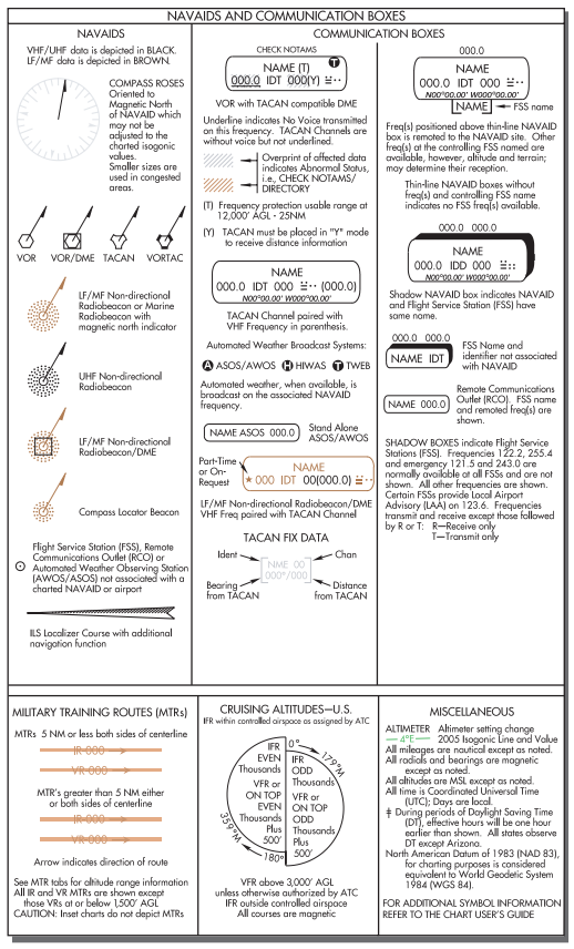
NDB's are the green circles in Plan-G.
ILS's are the green arrows.
VOR/VORDME/VORTAC/TACAN are the blue boxes surrounded by the compass. They should all have different symbols, but it appears this isn't a feature of Plan-G
Each station has a standard symbol which is "mostly" common across all simulators, and planning software.
-
Tomas Linnet
- Senior Master Sergeant
- Posts: 2286
- Joined: 05 Nov 2013, 10:48
- Location: Oksboel, Denmark
Re: Learning to fly the Connie
Plan-G shows the correct symbols, on my system any way. If the “information” window is open, Plan-G will show details on nav aids, also note the NDB’s use a different frequency range than both VOR and ILS. If more than one nav aid is in the same location, Plan-G will show details on all of them, they will show up in the window with their colours.
Kind Regards
Tomas
Sim: FSX SE
Accu-Sim aircraft in my hangar:
C172, C182, P51 Civ, P51 Mil, B17, Spitfire, P47, B377 COTS,
J3 Cub, T6, Connie, P-40, V35B
A2A Accu-Sim Avro Lancaster Loading:............0.000003% complete, please wait.
Tomas
Sim: FSX SE
Accu-Sim aircraft in my hangar:
C172, C182, P51 Civ, P51 Mil, B17, Spitfire, P47, B377 COTS,
J3 Cub, T6, Connie, P-40, V35B
A2A Accu-Sim Avro Lancaster Loading:............0.000003% complete, please wait.
Re: Learning to fly the Connie
OK, how can we see the differences between NV and CL radios beacon if both are green circled from Plan-G...... here to watch on it ....flapman wrote: ↑28 Sep 2020, 11:24You don't understand. They are separate systems.
NDB's are the green circles in Plan-G.
ILS's are the green arrows.
VOR/VORDME/VORTAC/TACAN are the blue boxes surrounded by the compass. They should all have different symbols, but it appears this isn't a feature of Plan-G
Each station has a standard symbol which is "mostly" common across all simulators, and planning software.
https://drive.google.com/file/d/1R7efFh ... sp=sharing
Pat
Re: Learning to fly the Connie
It is an Arrow big one pointing to the runway. I will take a look at them again I might find the answer, hold on ....(Very interesting).
Pat
EDIT:
I found NV (EHAM) is located at front of only one large arrow pointing to the runway. The CL is pointing to the runway 34R but also I can see 2 arrows instead of one. Anyway the CL navaids I see is pointing to only one runway and maybe partially to the other runway 34L. Is this something telling me which NDB can be used as ILS?
Pat
Re: Learning to fly the Connie
OK, if NDB is not ILS why a Captain will use a navaids that never will give DME? VOR gives me DME so I know how far I am from the destination airport. NDB doesn't give DME. This is what I learned so far (lol). But yes, now I think since the NDB usually is located at front of the ILS then I am flying ILS....... I guess. If so, then I was wrong before. I thought flying ILS, Connie can be straight to runway for landing like Jets using FMC.
Pat
-
Nick - A2A

- A2A Captain
- Posts: 13779
- Joined: 06 Jun 2014, 13:06
- Location: UK
Re: Learning to fly the Connie
Hello Pat,
I haven't been following this thread very closely, but can I recommend the following website:
http://www.navfltsm.addr.com/
It's intended to teach the basics of air navigation using ground-based navaids to flight simmers. Although the site is a few years old now, and isn't really designed for modern screen resolutions, I think you may find it useful if you haven't already seen it.
Thanks,
Nick
A2A Simulations Inc.
Re: Learning to fly the Connie
Captain want's to find ILS beams, not mountains at night or in fog. DME reads the same at both places.
Distance RJTT to Mihara VHF Omni Range (OSE 109.85) = 50nm. DME reads 50nm and it is time to turn.
Distance RJTT to top of Mount Fuji = 53nm. DME reads 53nm and you are dead.
Legal and safe departure from Kobe has DME counter go up. It must go up. You will learn this.
You will miss ILS. That's why Trev gave you and NV at EHAM. VOR and DME will be no help to you. Remember how you got lost EDFE to EHAM? You had DME entire time.. didn't help. You got lost. Simple NV NDB has no DME yet you find 36R ILS every day. Which is better for Connie captain?VOR gives me DME so I know how far I am from the destination airport.
We are over the top of CL NDB in Japan and you ask me the distance to RJTT. I can tell you this exactly. Nobody needs a rotating DME counter to know the answer.NDB doesn't give DME.
What is the name of the NDB in front of RJBE ILS 09? There is none. Many have no NDB. Many ILS have no DME either. Neither is required. Following a VOR course is required.But yes, now I think since the NDB usually is located at front of the ILS then I am flying ILS....... I guess.
Re: Learning to fly the Connie
Thanks to participate your help on this thread. From that link I visited before and just found something I didn't see until now.Nick - A2A wrote: ↑28 Sep 2020, 16:55 Hello Pat,
I haven't been following this thread very closely, but can I recommend the following website:
http://www.navfltsm.addr.com/
It's intended to teach the basics of air navigation using ground-based navaids to flight simmers. Although the site is a few years old now, and isn't really designed for modern screen resolutions, I think you may find it useful if you haven't already seen it.
Thanks,
Nick
The Glide Slope
The Glide Slope is the signal that provides vertical guidance to the aircraft during the ILS approach. The standard glide-slope path is 3° downhill to the approach-end of the runway. Follow it faithfully and your altitude will be precisely correct when you reach the touchdown zone of the runway.
Think of the glide slope as a localizer laying on its side, squirting a signal 3° up into the air, and you'll have it just about right.
Tracking the glide slope is identical to tracking a localizer. If the glide-slope needle swings away from center—up or down—maneuver the aircraft towards the needle by adjusting the engine's power. Don't point the aircraft's nose up or down.
Nick, my weakside always was don't understanding clearly on how the GlideSlope works. Regarding on ILS I think I understand better on how it works.
Patricio
Who is online
Users browsing this forum: No registered users and 23 guests