Flying the Comanche

Fly high, fast, and far in first class comfort
Hook
Master Sergeant
Posts: 1358
Joined: 31 Dec 2012, 01:38
Location: Bonham, Texas

Re: Flying the Comanche

Post by Hook »

Munich is a real resort area with some incredible things to see nearby. Garmisch-Partenkirchen is famous for its wood carvings and I still have a small wooden dog I bought there. I wish I'd thought to look for a chess set... I'd have paid almost any price for one from there. The Schloss Linderhof is nearby, along with Neuschwanstein castle. I rode a cable car to the top of the Zugspitze.

These are the things I remember off the top of my head (we left in 1975) and my wife and I visited the area twice. I still remember very well the second trip (by the excellent German railway system) with a group of GIs and their wives passing around a bottle of Galliano. :D

Nurnberg is famous for the Wall (I never indulged their wares myself but I did take someone there once) and the Christkindlmarkt Christmas market and I still have a lot of Christmas ornaments we got there. One of the wax ornaments is still in reasonably good shape. The metal, plastic and straw ones were great.

Frankfurt is the main airport where we all flew in and out of Germany from the US. I made decent money taking people to Frankfurt to fly home. Didn't quite pay for my car, but certainly paid for the expenses and my time. People were in a pretty good mood to be flying home on leave so the company was always pleasant.

Besides living in the area we did military field exercises and with my job in S3 Brigade Operations as their draftsman / map guy I got familiar with all the small towns. When I was playing tank crewman the only time I knew where I was was when I saw a road sign... if I even had an outside view from the tank.

Needless to say the fight brought back a lot of memories.

Hook

Hook
Master Sergeant
Posts: 1358
Joined: 31 Dec 2012, 01:38
Location: Bonham, Texas

Re: Flying the Comanche

Post by Hook »

Frankfurt to Stonehenge via the Waterloo battlefield. Actually it was EDFE to EGDM which was about 3 miles southeast of Stonehenge.

When I was planning the flight to Stonehenge I was lamenting the fact that I'd be close to the Waterloo battlefield and wouldn't get a chance to visit. But I soon realized that my flight path took me over Charleroi VOR GSY 115.700 which was just south of the battlefield; Charleroi is where Napoleon crossed from France into Belgium to engage the Anglo/Prussian forces. The battlefield is 13.9 nm on the 357 radial. The battlefield isn't anything to see, the land class doesn't show the fields and the correct buildings are not there. The Lion Monument may be but I forgot to look for it. :) I lamented somewhat more the fact that I was so close when I lived in Bamberg and didn't think to visit the real thing.

Channel crossing to the Dover VOR, no white cliffs in evidence. Down the south coast of England (where it FINALLY stopped raining), up a channel to Southampton and EGDM. I flew northwest looking for Stonehenge but I was looking in the wrong place. A later flight with a corrected Little NavMap point of interest and I *still* had to do a bit of searching; the Sim version appears to be maybe a half mile northwest of where it should be. Close enough.

THERE it is! Almost missed it. I'm looking south, that's the larger road that runs east/west to the south of Stonehenge.

Image

After turning around I approached it from the west.

Image

OK, it ain't spectacular, but it IS there in the sim. This is stock scenery so there may be a better version of it somewhere if you use custom scenery.

Hook

Hook
Master Sergeant
Posts: 1358
Joined: 31 Dec 2012, 01:38
Location: Bonham, Texas

Re: Flying the Comanche

Post by Hook »

Stonehenge to Glasgow and from there to the Faroes EKVG. We're gettin' into the exotic far north now. The Faroes are very interesting, too bad they're so far north and so out of the way.

I'm still getting constant rain. Flying to Glasgow I stayed under the clouds, wasn't a bad flight considering. Flying to the Faroes I climbed above the clouds. At about 9000 feet the temperature was down to just above freezing and I was *just* above the clouds. Then suddenly the temperature dropped and the clouds rose and I had to climb to get above the rain. I finally got to 11,500 feet and dodged clouds and rain the rest of the flight. I wasn't able to get above the clouds but I was able to avoid them mostly. I picked up some rain which caused some very minor icing, not enough to matter and it never lasted more than a few seconds.

The carb heat was on for much of the flight until I got above the rain. There have been several flights now where I got carb icing on the ground and the only time I turned carb heat off was after I went to full throttle for takeoff, then back again at altitude typically cruising at about 2000 feet.

I had to do my flight plan to pick up a VOR near my departure as the wind was something like 50 knots crosswind, eventually becoming a quartering tailwind. I had 15 to 25 degrees correction cranked in most of the time. I couldn't fly the VOR radial anyway as I was too busy trying to find clear paths through the rainclouds. Interesting that the VOR was at max range at the NDB at the south tip of the Faroes.

As I was approaching that NDB I saw a break in the clouds. Destination reported ceilings of 2900 feet, temperature of 4 C, hey no problem! I descended through the hole and flew the length of the islands at about 2000 feet. It got a little dicey near the destination though with dodging some low clouds, some turbulence and some island peaks to fly around.

Next major problem was a 22 knot crosswind 90 degrees off the runway. <sigh> Ok, I'll give it a try as there were no alternate airports. Lots of crab, lots of slip, got down on the runway, not a bad landing considering. I didn't bend anything and didn't get into the weeds. I got lucky though; earlier that crosswind was 26 knots gusting to 37. :D

Gonna be interesting weather on the way to Iceland. Still constant rain, still high winds, not many airports at the destination. Temperatures on the ground are above freezing though, so it may not be too bad.

Oh yes, I changed my oil to 25W60 for really cold weather. I got to find out just how well the heater works too: 76 degrees F over the outside temperature. OAT got down to -5 F or so at altitude.

Hook

User avatar
Paughco
Senior Master Sergeant
Posts: 2104
Joined: 30 Nov 2014, 12:27

Re: Flying the Comanche

Post by Paughco »

Again - nice flight! Thank you for posting! That Bavarian castle; I got to see it on a Rick Steves "21 Days Blitz of Europe" tour. One of the coolest things on the whole tour was when a Ju-52 flew over the castle as I stood outside on one of the upper levels. That airplane looked and sounded great! Looking forward to the next chapter! (sort of like waiting for the next Flash Gordon episode!).

Seeya
ATB
Image

Hook
Master Sergeant
Posts: 1358
Joined: 31 Dec 2012, 01:38
Location: Bonham, Texas

Re: Flying the Comanche

Post by Hook »

Good heavens! Someone else old enough to remember Flash Gordon on TV! :D

There was a major low pressure area just off the south coast of Iceland last night which was causing the major headwinds and crosswinds. This morning I see on windy.com that it has moved northeast and it's now giving me mostly headwinds, but there's another low heading my way that should hit in around four days. If it's in the right spot I'll have tailwinds the whole flight. :) I may not wait.

I found a .pdf file online that's the Pilot's Operating Handbook for a 1959 Comanche, same as Scott's! This should be the same manual that Scott has in his personal Comanche.

http://brianmichael.org/n5448p/N5448P_POH.pdf

This has been fascinating reading. It's the first time I've found a manual for a sim aircraft I was flying where everything in the manual was pertinent. Lots and lots of charts and graphs. Including all the supplementary material at the end of the manual, this has been the best manual I've ever read. There's even an excellent explanation of hypoxia. This is as good as any novel or pilot's memoir, it just doesn't include any story line. :)

Hook

Hook
Master Sergeant
Posts: 1358
Joined: 31 Dec 2012, 01:38
Location: Bonham, Texas

Re: Flying the Comanche

Post by Hook »

Ok, is it my imagination or do our two male passengers resemble Scott and Captain Jake? :D

Hook

Hook
Master Sergeant
Posts: 1358
Joined: 31 Dec 2012, 01:38
Location: Bonham, Texas

Re: Flying the Comanche

Post by Hook »

I didn't wait. I just landed at Reykjavik.

I figured the weather was good enough that I'd find way to deal with crosswinds. I just flew at 2000 feet and ignored rain as it was well above freezing at that altitude and I was below all the clouds. I knew I'd have crosswinds so I guesstimated a 15 degree offset and flew 290 rather than the 305 course I'd been given. Since I wasn't sure how strong the winds would be I kept my heading between 280 and 290. Early on I even had a convenient star to steer her by. :) Then the shadow of the window frame fell directly across the center of the dash and when that was gone I used features in the cloudscape. I was able to keep my desired 280 to 290 easily. It wasn't precise but neither was my flight plan, and I was able to keep my head outside the cockpit. I'd made a wild guess at what my average ground speed would and calculated I'd be at the VOR on the coast of Iceland at 10:30 after taking off at 07:55. I hit the VOR at 10:35.

I set my power to 2400 RPM, 18" MP, 11.0 gph fuel flow at peak EGT. Indicated airspeed was 145 at 2000 feet. When I hit some rain I didn't bother to wait for an indication of carb icing, I just pulled carb heat and advanced MP to 19". When the rain stopped I went back to 18" with no carb heat. Only needed some minor adjustments to throttle and trim to maintain altitude and speed.

About halfway to Iceland my nose veered right, indicating the wind had shifted. I turned back to 290. I shouldn't have, as the crosswind had become a straight headwind. I decided to keep on the 290 course even after I had the VOR as it would put me closer to my next waypoint. Still, when I hit the VOR at 277 miles I was only 26.2 miles off (according to the DME), just within the 10% target.

From the VOR I just followed the coast around. Iceland scenery is mostly boring, not dramatic but attractive enough. The Faroes are dramatic.

Next stop: Narsarsuaq.

Hook

Hook
Master Sergeant
Posts: 1358
Joined: 31 Dec 2012, 01:38
Location: Bonham, Texas

Re: Flying the Comanche

Post by Hook »

Reykjavik to Narsarsuaq.

Clouds the whole way except right at the destination but I was able to fly above them. Well, at 13000 on the altimeter I was skimming the tops of the clouds. Getting some occasional icing but never for too long. Even got some freezing rain at that altitude, no more than 5% icing.

I was wondering why I wasn't suffering hypoxia at 13k so I checked the density altitude: 14200 pressure altitude at -25 degrees C... looks like about 12,500 feet to me. Also got my true airspeed at the same time, about 170 mph with 142 IAS. Someone else check my math. There's a good table for in in the real world POH I mentioned earlier.

I didn't use ANY navigation cheats on this flight. There was a VOR near my departure but the destination had only a 195 mile DME and a 37 mile NDB. After the flight I checked my track when I went feet dry over Greenland: after 550 nautical miles I was about 6 miles off my expected target. Not bad considering I was 45 degrees off my course several times dodging clouds at my altitude. This was almost as bad as sailing a square rigger to an upwind destination. Somehow I always got where I was going.

My original flight plan had me at 2000 feet going around the south coast to the fjord leading to Narsarsuaq but I was still at 13000 feet altitude and decided to fly direct. I had to do some fancy triangulating with another longer range NDB, and at one point I was estimating the direction to the airport by turning until the DME showed the fastest ground speed. Eventually picked up the short range NDB and was able to home in easily. There are a lot of tricks you can use with VOR and NDB and I'm not sure they're normally taught.

Greenland doesn't have interesting mountains but one thing it does have in abundance is interesting fjords. I didn't try to use them for navigation but they made great sightseeing. I've been to Narsarsuaq a few times so I had some idea what to look for, but it was still pretty exciting to spot the airfield. Luckily the 13 knot wind had me landing from the water side... if the wind had been the other direction I'd have had to do a 13 knot downwind landing. My first ever visit to Narsarsuaq was in the stock Baron (about 2007 or 2008) and ATC had me approaching the wrong way. I had to go to external view to find the runway! After that I researched Narsarsuaq and found that you land and take off over the water no matter the wind direction.

I even overstressed the heater. OAT got down to -17 F, cabin was 60 F during that. Things that make you appreciate closed cabins and good heaters. :D Yes, I added the cabin temperature in farenheit to the clipboard dialog.

I had 4.8 hours logged for that trip, plus 4.4 for the flight to Iceland for a total of 9.2 hours today. Comanche has 84.5 logged hours and 77.3 on the Hobbes. Had to fix some oil leaks and a flap so far.

Oh, and I found out why when you change the oil that you only get 9 of the 12 quarts. The POH says that you don't fill the oil completely to prevent oil loss. Who knew? Next time I'll add a couple of quarts when it gets down to 8 or 9 rather than adding a quart at 11. Lots of goodies in that POH.

Hook

Hook
Master Sergeant
Posts: 1358
Joined: 31 Dec 2012, 01:38
Location: Bonham, Texas

Re: Flying the Comanche

Post by Hook »

I've mentioned my ASA E6-B a few times. You can get it on Amazon or directly from ASA. Amazon is a little cheaper. It comes with an instruction manual and the manual is available online.

https://www.asa2fly.com/Assets/SupportF ... Manual.pdf

https://www.asa2fly.com/

Image

Hook

Hook
Master Sergeant
Posts: 1358
Joined: 31 Dec 2012, 01:38
Location: Bonham, Texas

Re: Flying the Comanche

Post by Hook »

Holy cow that picture is big! Well, at least you can see the details.

Wanna fly to Goose Bay?

I departed Narsarsuaq about 10:00 local. Windy.com indicated 3000 foot ceilings for the first part of that trip so I stayed low for a while. When I got a bit too high I found out there was ice in them there clouds. No precipitation though.

Eventually I got out from under the low clouds and climbed to 5000. It was actually a pleasant flight. I expected high ceilings and started climbing hoping to fly at 9000 feet under clouds, but the clouds just kept on going up. I hit cloud tops at 12,000 and had to dodge around clouds and occasionally brush the clouds under me. Temperature was -27C which was too cold to form ice... at least in those clouds. Some other conditions would have produced some nasty icing.

When I hit land I descended through clouds (still no ice), got into some snow, no real problems as there was a VOR and and NDB near Goose Bay. I just flew down the channel to the airport. Flying low and into headwinds made my flight longer than it would have been if I'd stayed at altitude but I wanted to do a little sightseeing. It's been years since I flew that channel but I remembered it quite well.

I wasn't expecting much wind at altitude as windy.com had indicated light winds from variable directions with a strong crosswind at the destination. But by the time I made the flight I had 15+ knot crosswinds blowing me to the south. I didn't use any navigation cheats until I picked up the VOR at which point I found I was 48 miles off my course after 480 miles. This is the farthest I've ever been off course except a time or two when I messed up and flew the wrong heading. :) But it was *still* at the 10% limit.

The flight plan was easy enough: Depart at 256 degrees and turn south 4 degrees every hour. I'd have hit pretty close if I hadn't had the crosswind.

I logged 5.3 hours, 89.8 logged for the Comanche, 82.3 on the meter.

Next flight possibly to Quebec.

I put in a click spot on the clipboard to hide the Power Settings and Checklist areas during cruise flight when those aren't needed. I still have temperature and speed/range information which is all I need during flight. Old programmers never die, they just customize the heck out of their sim aircraft. :D

Hook

Hook
Master Sergeant
Posts: 1358
Joined: 31 Dec 2012, 01:38
Location: Bonham, Texas

Re: Flying the Comanche

Post by Hook »

I took off from Goose Bay bound for Quebec and flew a heading of 218 toward a VOR on the coast, keeping low to avoid strong headwinds. It was the usual flight these days: dodging clouds. Visibility wasn't very good, never more than 20 miles. I had light turbulence the entire 200 nautical miles. Anyone complaining about "flying on rails" should have been there.

At the coast I turned right and followed the shoreline. Visibility was worse. That didn't really matter as the flight was pleasant enough. The Active Sky weather map showed precipitation ahead so I was prepared for it.

What I wasn't prepared for was hail mixed with freezing rain. Ice started accumulating in the precipitation but not nearly as quickly as I'm used to with freezing rain. I found that if I plugged in the headset it muted the engine sounds enough that I could hear the hail hitting the fuselage. :D So I had a rough choice: the airport behind me was about 75 miles, the one ahead was 25. DME showed 15 minutes to the airport. In typical freezing rain I probably wouldn't have considered the airport ahead. "You have about 10 minutes in freezing rain. If you aren't on the ground in 15 minutes, you will be in 20." But the ice wasn't accumulating that quickly so I figured I'd chance it. A few minutes later it turned to snow, the ice went away and I had no more problems.

That airport was Sept Iles, CYZV, and I decided that rather than chance any more freezing rain I'd land and spend the night waiting for better weather.

The mechanic's notes said to inspect the engine, and the engine said it needed the oil and filter replaced. My first change was around 42 hours and I was now at 85. But at 70 hours I'd changed to winter oil. I guess it was telling me it needed a new filter and the oil change went along for the ride. I put medium weight oil in this time as I hope to be heading for warmer climes soon.

I am currently "sitting in my hotel room" in Sept Iles after a night's sleep, writing about the flight. I haven't checked the weather yet. There is a stray cat outside acting like it wants to be fed so I better go do that. I may look up at the sky at that time if it's not too bright for my recently-awakened eyes.

Hook

Hook
Master Sergeant
Posts: 1358
Joined: 31 Dec 2012, 01:38
Location: Bonham, Texas

Re: Flying the Comanche

Post by Hook »

Weather maps say COLD, headwinds, no precipitation, some areas of reduced visibility, 4000 foot ceilings. I didn't plug in the engine heater last night, OAT is -2 C. Well, it started last time although it took two tries and drained the battery considerably.

Previously mentioned cat was gone when I got outside so I left some food for him. Hope he appreciates it.

Oddly enough the fuel prices are cheaper in Quebec than in Sept Iles: Canadian $2.06 per Liter at Quebec versus $2.56 per Liter at Sept Iles. I started at Goose Bay with full fuel including tip tanks so I should have enough that I can wait until Quebec to refuel, about 2.5 hours away.

I've decided to hold off breakfast until I get to the city. Caffeine won't wait, however. Maybe, just maybe, the visibility will be better on this trip. Does everyone get as excited as I do by the prospect of flying?

Hook

Hook
Master Sergeant
Posts: 1358
Joined: 31 Dec 2012, 01:38
Location: Bonham, Texas

Re: Flying the Comanche

Post by Hook »

Parked at Quebec, CYQB.

I posted earlier that the weather was COLD. That wasn't really true, the temps were barely below freezing. I must be getting confused by sub-zero Fahrenheit and sub-zero Celsius. Heck, you didn't even need a parka! :D Engine started with no problems; I figure the last difficult start was due to over priming.

It was near perfect flying weather. Ceilings around 4000, visibility 25-30 miles. Some headwind but who cares? :) Easy navigation down a shore line.

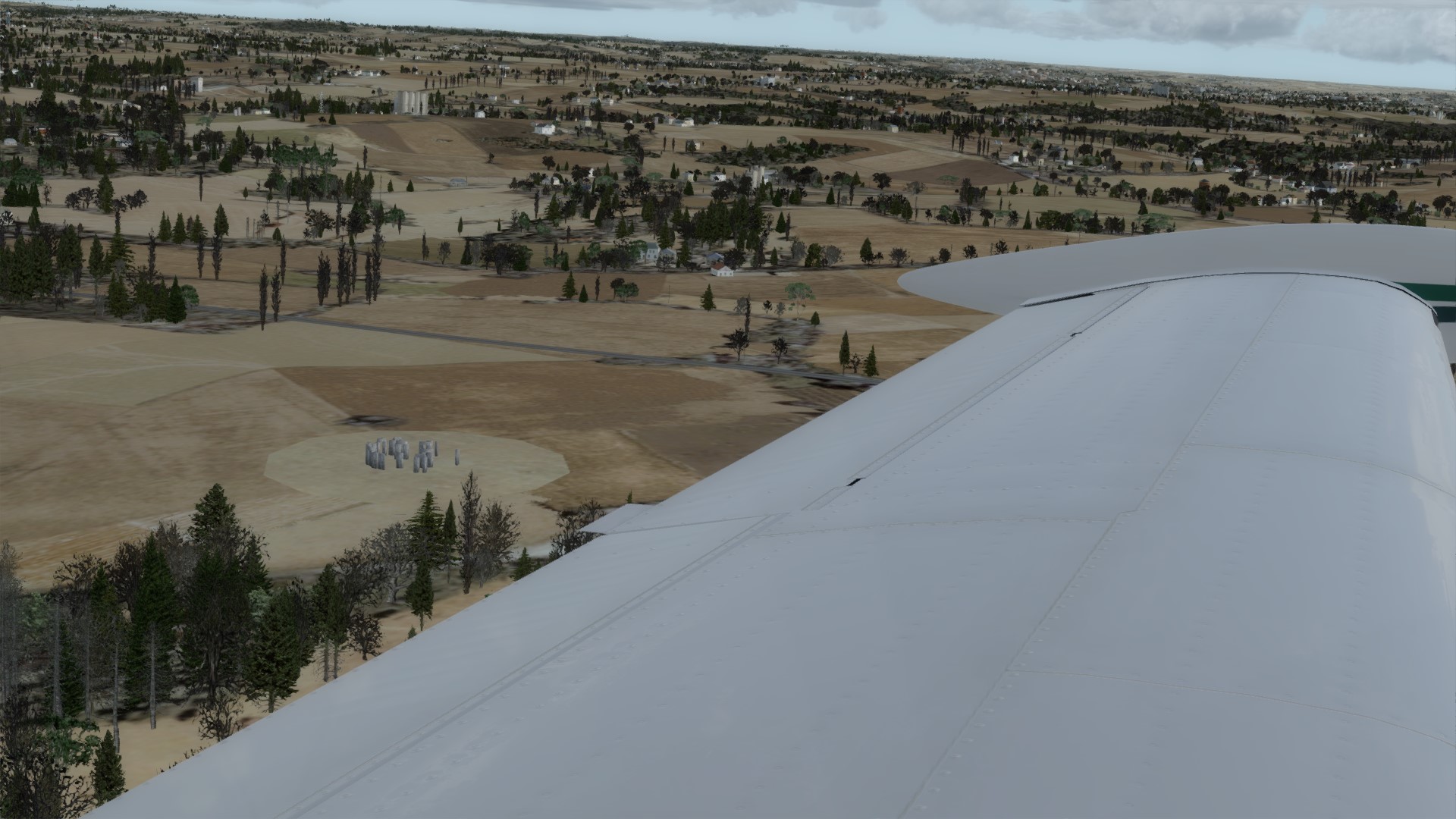
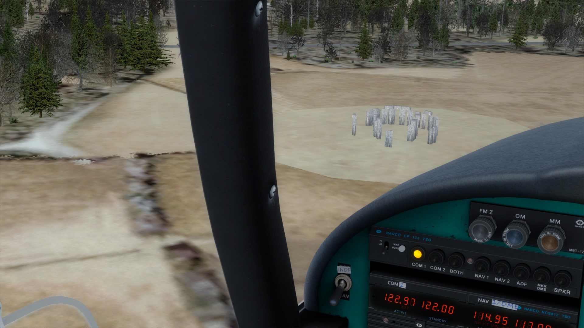
When I got into the St Lawrence River there were hills making the area quite scenic. It was an attractive landscape, snow covered, small towns, a few islands in the river. I really enjoyed the flight.

I even called ATC to land. I figure the Comanche is good enough that I should probably be using more real world techniques. I'll occasionally use ATC but hadn't lately. Besides, I wanted to see if Little NavMap did anything special with Progressive Taxi. But that wasn't available, likely because the fuel pump didn't have a path to the actual pump at CYQB. Maybe on the next flight as the parking spot is connected to the runways by paths. I still had 12% fuel after I landed, no fuel problems.

I held off breakfast until Quebec; I'll eat after posting this. I figure the big city would have a better quality of greasy spoons than the small town. But since this is breakfast for me anyway, just how epicurean can you get? :D

Actually, the best breakfast I ever had was in a hospital cafeteria. That's not a joke: my wife was having eye surgery at Zale-Lipshy hospital in Dallas and they had a five star chef. Breakfast rolls to die for, no kidding. Less special were the scrambled eggs but still great.

Heh! I just remembered the best coffee I ever had was also in a hospital. Wife was at Columbia Hospital for Women in Washington D.C. giving birth to my son, and her roommate was in the Diplomatic Corps with Colombia. She had some coffee beans flown in from Colombia in a diplomatic pouch and offered us some brewed coffee. Now, I'm not a coffee drinker, but I tried a cup, black. This was by far the best coffee I've ever tasted. The only word I could use to describe it is "rich." And not grocery store coffee "rich" either. Not a hint of bitterness. An incredible experience.

The best tea was a tiny bit remaining in a container someone had left at work after finding another job, back around 1997. I saw him some time after and asked about the tea. "$1000 per kilo in Hong Kong." <sigh> That's probably the $3000 per kilo green tea that's the most expensive in the world. If you get a chance, try it... $15 per cup from what I hear, and it's worth it.

The best chocolate was from the same job. A couple of the guys from eastern Europe went home for a visit and brought back some Belgian chocolate. "Frucht-de-Mer" was the brand name. It doesn't get any better than this.

OK, enough digression.

I don't know if the Comanche will ever become my favorite plane, but I can state that it is the best plane in my hanger. That stable includes the Stratocruiser and the Connie, the Cessna 172 and the Piper Cherokee, and the Cub and the Comanche, all from A2A. The aircraft that have the most flight time are two versions of the Golden Age Stearman, the Manfred Jahn C-47, and the Aerosoft BeaverX converted to run in P3Dv4. Then the Cub, Connie, Cherokee and Comanche, which now has 96.6 hours.

I haven't flown the Great Lakes much, so I'll probably do some exploring there next. I haven't decided yet.

Hook

User avatar
Paughco
Senior Master Sergeant
Posts: 2104
Joined: 30 Nov 2014, 12:27

Re: Flying the Comanche

Post by Paughco »

Hook, I really enjoy reading your debriefs. You have earned the Krusty Seal:

Image

Please keep flying and keep posting. I also really enjoy my A2A Piper Comanche.

Image

Seeya
ATB
Image

Hook
Master Sergeant
Posts: 1358
Joined: 31 Dec 2012, 01:38
Location: Bonham, Texas

Re: Flying the Comanche

Post by Hook »

Thanks Paughco! I'm tempted to use that as an avatar. :D

The Comanche is at 99.6 hours... so close, so close...

I got a late start leaving Quebec City intending to fly to Toronto. I got to Kingston at the upper right corner of Lake Ontario and decided I didn't want to fly past sunset.

South of Quebec the scenic hills went away and it was all flat on either side of the river. Not bad but not great either. Visibility was 20 to 30 miles except one time it opened out to 75 for a while. That's a slightly hazy day way out west but atypical for the northeast. :) Mostly I just enjoyed flying along the river. Ceilings around 4000 feet again. Headwind the whole way. Again.

I called ATC for departure and got my answer about Little NavMap and progressive taxi: it doesn't do anything. However, having a good map of the airport made finding the taxiways very easy. I knew right away where ground control wanted me to go.

I called Montreal for clearance to transition their airspace which was a bit of a pain to get the airport to come up in the list of nearest airports, but once I had it everything was good. I didn't want to use flight following to automate the process. Sometimes I tune a specific ATIS which means I have to look it up on the chart. "Advise controller on initial contact you have Whiskey." :D (Not a chance! He'll want me to share.) I'm figuring out techniques to determine the limits of an airspace without a GPS. DME helps but isn't absolutely necessary.

For what it's worth, I manually tune all the radios. When I first started doing that it took a fair number of repetitions before I got it down to a routine. I quickly understood why training sims have actual radio knobs you need to tune.

Something I started with the Cherokee: When I secure the Comanche after a flight I don't use the controls panel to tie down the plane and set the chocks, I use the walk around. It's just so cool that we can do that! I don't do a complete walk around, just the tie downs, chocks, pitot cover, check the oil and lock the baggage compartment but I go through every station just to get eyeballs on every part of the plane after a flight.

From Toronto I'll fly up the land between Georgian Bay and Lake Huron and maybe around the top of Lake Superior, maybe around the bottom. The Great Lakes are kinda special to me because my biological father spent time as a ship's cook on a Great Lakes merchant ship. When I first heard about that I didn't even know merchant ships plied the Great Lakes. :)

If there's any interest I'll make a long post on how I make a flight plan. It includes Google Earth, windy.com, SkyVector.com, Little NavMap (originally FS_FllightControl), my E6-B and some verification of weather in the Active Sky map and flight planner. There is some special processing for a great circle flight.

Hook

new reply

Return to “Piper Comanche 250”

Who is online

Users browsing this forum: No registered users and 33 guests