Flying the Comanche

Fly high, fast, and far in first class comfort
Hook
Master Sergeant
Posts: 1358
Joined: 31 Dec 2012, 01:38
Location: Bonham, Texas

Re: Flying the Comanche

Post by Hook »

Kingston to Toronto. About a half hour into the flight the sky cleared. I couldn't remember the last time I didn't have a total overcast! Flight to Sault Ste Marie was routine.

The flight to Duluth was as pleasant as I've ever experienced. I followed the southern shore line of Lake Superior. Nice weather, good visibility. Reasonably attractive scenery.

When I was planning the flight from Duluth to my home airport in Bonham (60 miles northeast of Dallas) I realized that highway 35 ran the whole way. It jogs right at Kansas City going to Wichita then straight south to Lake Texoma. Does anyone else think that lake looks like a dragon breathing smoke? :D

Windy.com had nice weather as far as Des Moines, but it got pretty nasty south of there. I originally intended to fly to Kansas City but landed at Des Moines instead. That airport is only a mile or two from my brother-in-law's house so I guess I'll do a quick visit to see his family. My first long flight after an initial check ride in the Comanche was to visit him. He's a nice guy, he doesn't mind frequent visits.

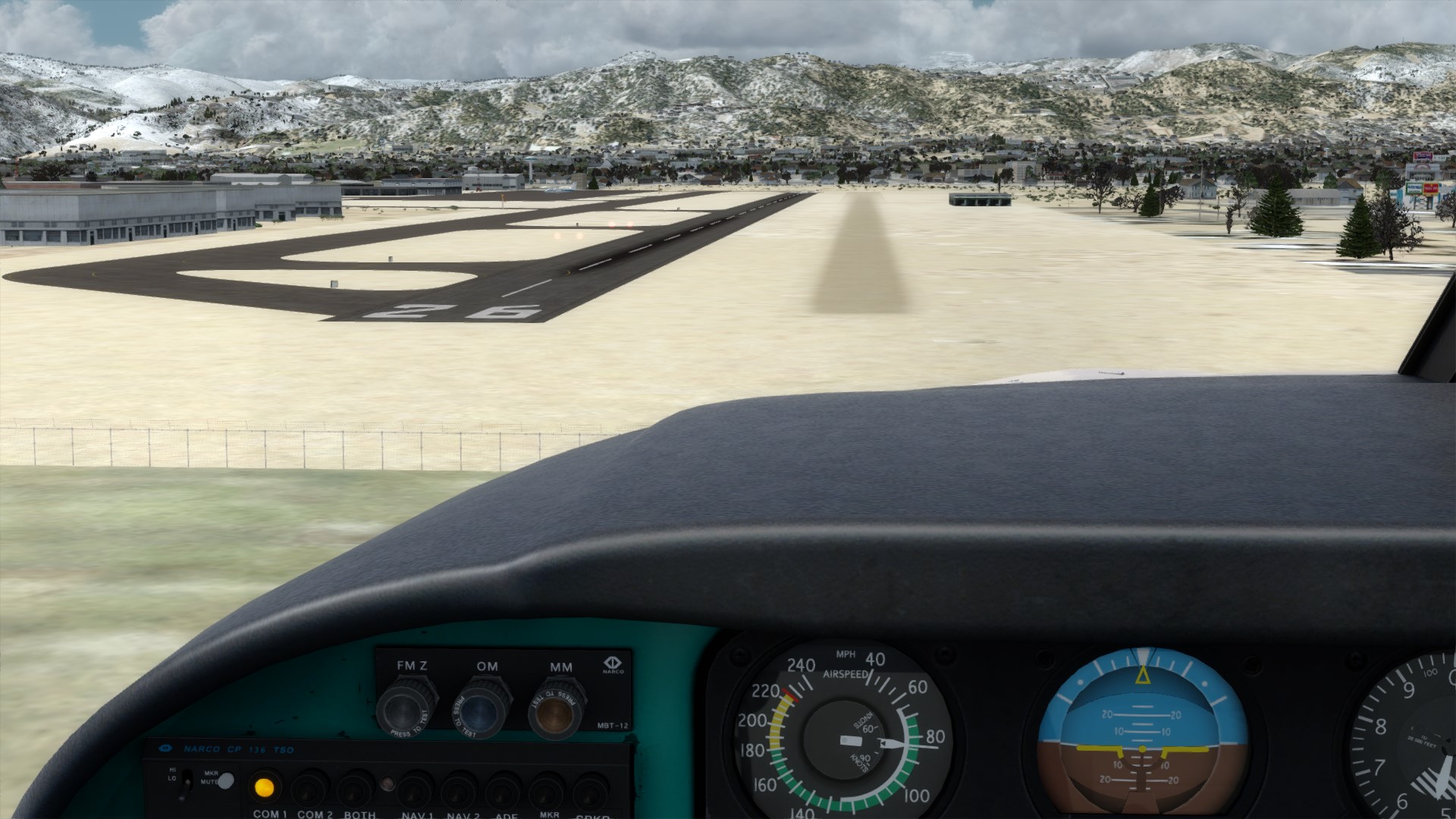
Gorgeous weather on the flight. Right around freezing, high scattered clouds (15,000+), great visibility. I even had tailwinds! I flew along the highway and only used VOR/DME for situational awareness, using the highway for navigation and landmarks for progress, following along on the SkyVector charts. This is how I prefer to fly. Snowy scenery was pretty, varied and interesting and I never got bored with it and I enjoyed the entire flight. The flight was as pleasant as the previous one. Very low stress.

I didn't use the radio but I did turn on flight following to get through the controlled airspace at Minneapolis. I'd use the radio more if there were a way to reset the ATC state to a default while in the cockpit. If it gets out of sync the ATC gets hung up and doesn't work. For example, I parked in a different spot than what ground control had assigned me and I couldn't continue until I taxied to the right spot before departure. It's possible to clear the ATC state by deleting the necessary lines from the saved flight file but I forgot to do that.

It was crazy windy earlier here today. Last report I had was 18 knots gusting to 28, earlier it was gusting to 36. I just looked outside and it's not doing that now.

110 hours logged on the Comanche, 100.7 on the Hobbes. When the oil gets down near 8 quarts I add another quart to keep it near 9. I'll have to check the manual on that again to see exactly what it says.

Hook

Hook
Master Sergeant
Posts: 1358
Joined: 31 Dec 2012, 01:38
Location: Bonham, Texas

Re: Flying the Comanche

Post by Hook »

I've got two flight plans made: One to my home airport in Bonham and another to Denver as I'd really like to get into some mountain flying. They are both about 4 hours or a little more so there's no time-based reason to favor one over the other.

Weather on the route to Denver is currently a little sub-optimal. Windy.com shows snow over most of the route and Active Sky has many stations reporting freezing rain with others nearby reporting hail, which is likely mixed with freezing rain. I'm holding off on the flight for now. It's either that or fly with historical weather. It's really too bad because cloud bases and visibility are perfect for flying that route. Lots of crosswind from the north but no headwinds.

Windy.com is great because I can find not only wind speed and direction at various altitudes but also precipitation and cloud bases and ceilings and visibility, plus the freeze level altitude as well, all of which are very useful. I've started using windy.com to get the local weather where I live rather then looking at a normal weather map. :) One interesting mode shows animated lightning strikes along with an expanding circle showing where you'll hear the thunder.

The Breitling around the world flight in the DC-3 used windy.com to get barometric pressure reports when flying from Japan to the Aleutians, and they said when they got the first report from their destination that windy.com was pretty much spot-on.

Hook

Hook
Master Sergeant
Posts: 1358
Joined: 31 Dec 2012, 01:38
Location: Bonham, Texas

Re: Flying the Comanche

Post by Hook »

I really wanted to fly. It was too nice a day not to fly. The weather can change a lot in the 3 to 4 hours it would take me to get to the worst of it, and if I encountered something I didn't want to fly through there were plenty of places to land. So... I flew.

I turned right at the wrong road at Lincoln, a few minutes too early. I expected to see the airport to my right and I found it off to my left. There were parallel roads running west and I'd picked the wrong one. The other road was right off the end of the runway at the airport and I continued the flight without problems. These things happen occasionally.

There was snow on the ground from Des Moines to Lincoln. After that the snow went away and I had brown ground with occasional vegetation.

At about 1.5 hours in I tried the autopilot for the first time, as I needed to be away from the keyboard for a few minutes, and then I experimented to see what the autopilot could do. Not too bad, it will keep the wings level without regard to heading, it will hold a heading, it will track a VOR or localizer, and if you've got one of the headings set it will hold an altitude. There's no way to hold an altitude and hand fly a heading. Too bad. After 15 minutes I turned it off. I'll only use it if I have to leave the computer during a flight as I find hand flying to be better for the way I usually fly.

As I was approaching Sterling, about 100 nm from my destination, the clouds started to descend, and a few minutes later I was in precipitation which was causing some ice. I landed at Sterling. After landing I checked flight services at the FBO and the precipitation was localized to around Sterling. I could continue the flight if I didn't mind some icing in the beginning. I decided to wait and fly another day.

Hook

Hook
Master Sergeant
Posts: 1358
Joined: 31 Dec 2012, 01:38
Location: Bonham, Texas

Re: Flying the Comanche

Post by Hook »

After a break a check of the weather map revealed that the precipitation had moved south making the route to Denver clear. I anticipated a 45 minute flight. Some lower ceilings kept my altitude down on the first part of the flight but it soon opened up. I just followed roads all the way in.

Actually, I landed at Boulder, KBDU on the charts, 1V5 in the sim. This is Stephen Coonts home airport for the Cannibal Queen. Seeing those mountains appearing in the distance must have given the author quite a thrill with the feeling of Coming Home. I could see Denver in the distance above my left wing tank.

I decided to land on the grass runway. Mostly because it was there, and because I wanted to see how the Comanche felt doing a grass landing. It was great... barely knew when I touched down.

Image

A good flight, not sure where I'll go next, but there are plenty of scenic areas nearby. :D

Currently 114.8 hours on the Comanche, 105.1 on the meter.

Hook

User avatar
Medtner
A2A Mechanic
Posts: 1350
Joined: 30 Sep 2013, 10:10
Location: Arendal, Norway
Contact:

Re: Flying the Comanche

Post by Medtner »

Interesting to see how others also land at airports they know from fiction.

I have a connection to the Boulder area from "The Stand" by Stephen King. Love that book so much. I always fly into Boulder when I'm in the area in the sim. In fact I know it so well that I just glanced at the pic, recognizing the mountains thinking this must be Boulder. :-P

Also, just east, Erie airport is heavily featured in "The Dog Stars" by Peter Heller. This is a post-apocalyptic book featuring a guy who is a pilot, flying around in his Cessna in the area. Masterpiece, and food for aviation enthusiasts too.
Erik Haugan Aasland,

Arendal, Norway
(Homebase: Kristiansand Lufthavn, Kjevik (ENCN)

All the Accusim-planes are in my hangar, but they aren't sitting long enough for their engines to cool much before next flight!

Hook
Master Sergeant
Posts: 1358
Joined: 31 Dec 2012, 01:38
Location: Bonham, Texas

Re: Flying the Comanche

Post by Hook »

I've read The Stand several times, most recently twice back to back. :) I also found a copy of the movie and have watched it a few times. Y'know, I never even thought about Boulder. The only thing I remember with Boulder in it besides Cannibal Queen is Mork and Mindy and Robin Williams before he became famous as a comedian. :) I appreciated him a lot more after I saw some of his comedy acts. I'll look for The Dog Stars; I need something to do when the weather is too bad to fly and I don't want to load historical weather. :D

Boulder to Aspen via Vale and then to Telluride: The Mountain Resort Tour (tm).

Mountain flying is as scenic as it can get but it's also as treacherous if you don't have a GPS. If you're trying to follow roads or rivers they're often sunken in valleys with very steep walls and impossible to see if you aren't lined up with them, and the Comanche doesn't have *quite* enough visibility for this kind of thing. It is SO easy to take a wrong turn and get lost. Then there is the possibility of mountains hiding somewhere in the clouds. You can't always avoid the clouds; it is essential that you avoid the mountains. I experienced all this in those two flights. About the best thing I can say about the first flight is that I didn't bend the airplane. The second flight, once I got to reasonably clear terrain, was pleasant.

I took a wrong valley on the second flight leaving Aspen and trying to follow the terrain I suddenly noticed on the gyro compass that I was flying back the way I came. The chart was near useless in this situation. I used every cheat I had available (Shift-5 map, Little NavMap tracking my plane) and got reasonably back on course. A GPS would have helped a lot. For most flying I prefer to avoid the GPS.

If you've flown an area a lot it's easy to find your way. The first time you fly a mountain route you're better off flying as copilot with someone who is already familiar with the area. For example, flying the Merrill Pass in Alaska is simple now, but it wasn't the first few times I flew it. :)

At one point I was at full power and worried that I'd clear the ground in a pass I was flying through. I can't guarantee this pass was part of my flight plan as I only knew I was going in about the right direction. I wasn't lost, just a mite confused.

I'm about ready to be done with mountain flying for a while. Next stop tentatively is Salt Lake City.

Hook

Hook
Master Sergeant
Posts: 1358
Joined: 31 Dec 2012, 01:38
Location: Bonham, Texas

Re: Flying the Comanche

Post by Hook »

Salt Lake City.

The flight from Telluride to KSLC was a lot nicer than the flights from Boulder. The scattered crags along the route were not nearly the navigation hazard they were on the previous flights.

Variable temperatures as I passed over high ground caused me to have to adjust the cabin heat fairly often but I left the mixture alone after tuning it for the colder temperatures. I run close to peak EGT and if it gets rich of peak due to warmer temperatures it won't hurt anything. I just had more power than usual for a while.

While I still had the mountainous scenery, once I got closer to SLC I was in standard American desert which could be more attractive with a little work. Or a little snow. :) There didn't seem to be much wind at 10,000 feet and there were enough clouds around to make an attractive skyscape but not enough to cause problems or make me deviate from my flight path.

I used hybrid navigation again. I tuned the VORs and used them but mostly followed the roads. A pleasant flight overall. The Comanche is a pleasant ride and a pleasure to fly, not to mention attractive. :) It still has that solid refined feel after all these hours.

Hook

Hook
Master Sergeant
Posts: 1358
Joined: 31 Dec 2012, 01:38
Location: Bonham, Texas

Re: Flying the Comanche

Post by Hook »

Boise.

The flight from Salt Lake City to Boise went without much incident. I laid out a plan that used VORs but followed roads the entire way. I flew at 6500 feet which was about right for seeing details on the ground without being too low.

Salt Lake City is on the edge of a large lake bordered by mountains. I did a lot of ridge gliding in the area back in the FSX days with CumulusX. It is actually very interesting if the visibility is high enough. At one point I had 35 mile visibility and could see the mountains on the other side of the lake.

SLC didn't have much snow on the ground but as I flew northeast I was into and out of snowy areas. Roads are a lot easier to see in snow because they're black. If there's no snow they're gray against a tan background.

At one point I somehow got into a cloud that produced some minor icing for a while. I was on autopilot doing something in the cockpit and didn't notice at first that I was in a cloud. It was odd that this was the only cloud I flew through on the entire two hour trip. There weren't any others even close. This is one reason I don't like using the autopilot as you can get away with not paying a lot of attention. Visibility increased and decreased several times but I never got any carb icing.

The problem with trying to use VORs and follow roads is that the roads just don't respect the straight line between two VORs. :) The main reason to use VOR in those cases is to keep track of distance on the DME and find your way if you somehow lose the road, which happens occasionally. Sometimes there's no convenient VOR but there is an NDB and I'll use that. If nothing else it tells me exactly when I pass the station.

Next stop is somewhere around Seattle. That's about 4 hours away so I may stop and rest somewhere along the way.

Logged: 122.3 hours, Hobbes: 111.8 hours. It looks like the Hobbes records all but 0.2 hours on any given flight. This may be either the pre-flight or taxi time at one or both ends of the trip.

Hook

Hook
Master Sergeant
Posts: 1358
Joined: 31 Dec 2012, 01:38
Location: Bonham, Texas

Re: Flying the Comanche

Post by Hook »

I stopped at KPSC for the night after deciding I didn't want to fly after dark. This morning I flew on to KBFI.

The roads don't follow the VORs and sometimes the chart doesn't quite match the terrain, or at least I'm not able to translate the chart to the outside world as well as I'd like. I won't speculate about age related problems with concentration. :D I've had flights that I enjoyed more.

I updated the magdec.bgl before the first flight but it didn't help as much as I'd expected. I updated the entire database before the second flight. The numbers on Little NavMap match SkyVector.com somewhat better, at least, and now the sim has the correct frequencies, but I'm missing a lot of NDBs that have been decomissioned in the years since 2006.

I spent 5 hours overnight downloading pieces of the update to P3Dv4.5 during my midnight to 5 AM unmetered time and a few hours the night before. This went better after I switched from using Chrome to Firefox as Chrome doesn't have a resume function while Firefox does. I had an average of 5 to 10 restarts for each of the 1.5-2 gig files. Chrome doesn't do restarts. I finished two books I'd been reading while waiting for the downloads. It looks like I can expect 3 gig per hour downloads, 4 on a good day.

I updated the client before doing the second flight but I couldn't tell much difference. I wasn't getting a frame rate increase and the textures didn't appear different. I'd already updated Active Sky for hotfix 2 but it complained after I updated the P3D client about ASConnect and I had to do that update, which didn't seem to take but worked after a couple of restarts. The first time I booted P3D after updating the client and deleting the shaders it had a black screen for a minute or two then suddenly came up in the cockpit. I'm guessing that was the shaders. P3Dv4.5 appears to be working as advertised now. Next will be to update the content and scenery. Speaking of scenery I didn't notice any disappearing buildings but I did see the flickering on that one barn. Maybe one of the other updates will help.

The Comanche with 126.1 hours just passed the Cherokee with 125.9. That's on my current installations of P3Dv2.5 and P3Dv4.x, but I have more on the Cherokee in previous installations going back to FSX.

Hook

Hook
Master Sergeant
Posts: 1358
Joined: 31 Dec 2012, 01:38
Location: Bonham, Texas

Re: Flying the Comanche

Post by Hook »

A flight in the Cub indicated that my frames have dropped from 50-60 to 35-45 with the udpate. The "perception" of lower frame rates has been from two flights so far but it looks consistent. I still saw 60-70 when looking out over the ocean.

Now, I'm not a frame rate junkie and I can't tell the difference just from looking, but it makes TrackIR less responsive and I do notice that. Looks like I'll either have to lower my settings or accept the slightly lower frame rate.

Hook

Hook
Master Sergeant
Posts: 1358
Joined: 31 Dec 2012, 01:38
Location: Bonham, Texas

Re: Flying the Comanche

Post by Hook »

On the next flight my frame rate seemed to be back to normal. I'll chalk this one up to something with the cloud cover.

I'm going to park the Comanche for a while and go back to flying the Cub. See you in the Cub forum.

Hook

User avatar
Lewis - A2A
A2A Lieutenant Colonel
Posts: 33300
Joined: 06 Nov 2004, 23:22
Location: Norfolk UK
Contact:

Re: Flying the Comanche

Post by Lewis - A2A »

Worth noting that clouds can really kill performance so worth a tweak in your cloud settings if under heavier weather you are getting hit a little hard.

cheers,
Lewis
A2A Facebook for news live to your social media newsfeed
A2A Youtube because a video can say a thousand screenshots,..
A2A Simulations Twitter for news live to your social media newsfeed
A2A Simulations Community Discord for voice/text chat

Hook
Master Sergeant
Posts: 1358
Joined: 31 Dec 2012, 01:38
Location: Bonham, Texas

Re: Flying the Comanche

Post by Hook »

It's definitely the clouds, but I don't remember them being quite that bad on frame rates. I'm currently flying the Cub with frame rates in the 30s on days with lots of cloud cover and it's not a problem. I usually notice TrackIR not being responsive enough when it gets down around 20. Good to go for now.

If it gets to be too much of a problem I'll tweak the clouds in ASP4.

Hook

MadMac388th
Airman First Class
Posts: 97
Joined: 18 Nov 2014, 10:05

Re: Flying the Comanche

Post by MadMac388th »

I have really enjoyed reading your thread. What you described as hypoxia is only the beginning. If you stay above 14,500 longer the “symptoms” get worse and worse. A2A has done a better job with this than any sim I have ever experienced.

Hook
Master Sergeant
Posts: 1358
Joined: 31 Dec 2012, 01:38
Location: Bonham, Texas

Re: Flying the Comanche

Post by Hook »

Thanks, MadMac! Glad you're enjoying the stories. I appreciate the feedback.

And thanks for the info on A2A hypoxia. I remember when flying the Cherokee, I'd flown from Central America to the Galapagos then to Quito and I was worried about hypoxia when I hit 13000 feet to get over the mountains there. I knew some A2A aircraft modeled hypoxia but I didn't know if the Cherokee did. Never got any symptoms but I didn't stay at altitude any longer than I had to... just the threat of hypoxia is enough to keep you honest. :)

---

As for frame rates, I'm seeing 60-70 in good conditions and the cloudy conditions have higher fps than I remember, so I gotta assume I'm getting better frames per second than before the update. I'll have to watch for a while and see what it's like long run, but it appears to be a 10% increase on the high end, maybe even more in heavy cloud cover.

Hook

new reply

Return to “Piper Comanche 250”

Who is online

Users browsing this forum: No registered users and 18 guests